Llanfyllin
Some Victorian maps
  Llanrhaeadr-ym-Mochnant in 1835  
 

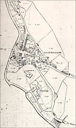
The map below is based on the tithe map of 1835 and gives us an idea of this border communityin the early Victorian period.
The Denbighshire side of the river was drawn seperately from the Montgomeryshire side, but we have put them side by side here to make it easier to see what the village was like.

 
  Llanrhaeadr tithe map
 

However remote this village may have seemed from the large towns and cities, the census returns of 1841 show that this was a thriving community in early Victorian times.
As you can see from the maps above, local people exploited the fast flowing waters of the river to power water mills. As well as the millers there were a whole range of tradesmen and craftsmen working in the community at that time.

The Mongomeryshire part of the parish alone had 6 wheelwrights, 6 shoemakers, 8 tailors, 6 weavers, 2 dressmakers, 3 coopers, 3 butchers, 4 blacksmiths, 2 joiners, and a tollkeeper.
It also had Lewis Usher, a bookbinder, and a Police Constable Robert Owens.

Compare with Llanrhaeadr in 1902...


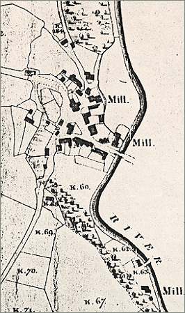
TITHE MAPS
In Victorian times almost everyone had to pay tithes to the Church of England. At the beginning of the reign the tithe became a tax on your property. The maps were drawn to see what property everybody had
 

Back to Llanfyllin maps menu


Link to sources
Back to top
Go to Llanfyllin menu