| Llanrhaeadr-ym-Mochnant in 1902 | ||
|
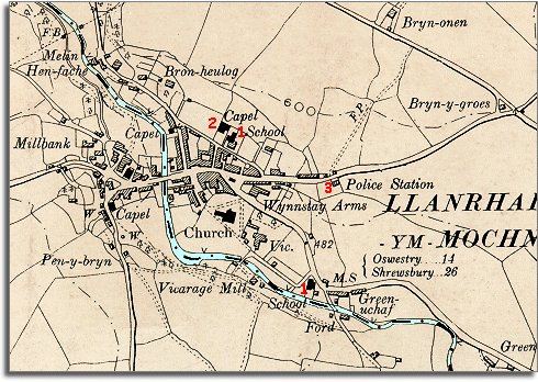
The map below is a section of a map
made at a scale of 6 inches to
1 mile in 1902. |
|
|
1. Although Llanrhaeadr had both a British and a National school in early Victorian times, the map shows the new schools that were built in the village. By 1902 all children had an education. This really did make a big difference to ordinary working people growing up in the area. Learning to read and write and do basic arithmetic gave children a chance of better job opportunities when they left school. Even so, a great many children would still grow up to work on the land or go into service. (See the School Life pages for more on Victorian schools in the area.) 2. At least one new chapel has been built in the village offering local people another way of worshiping. These chapels also organised many other activites for their members and many conducted all their activities in the Welsh language and so helped preserve the language and traditions. 3. Although Llanrhaeadr had a local policeman from the 1840s, the village now has a fine new police station on the road to the east. |
|
|
|
|