
TITHE MAPS
In Victorian times almost everyone had to pay tithes to the Church of England. At the beginning of the reign the tithe became a tax on your property. The maps were drawn to see what property everybody had.
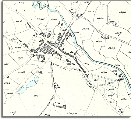
| Llanfyllin in 1850 | ||
| The map below
is based on the tithe map of 1850 for
Llanfyllin. From it we get a picture of the town in the early Victorian
period. We can see from the layout of the town that this is a community - like many of the others in Powys - which grew up where roads meet and there was a good river crossing. |
|
TITHE MAPS In Victorian times almost everyone had to pay tithes to the Church of England. At the beginning of the reign the tithe became a tax on your property. The maps were drawn to see what property everybody had. |
|
From the top left of the map to the
bottom right we can see the main route down the valley
of the River Cain. Going off at right angles to this is the
road over the river to the smaller communities to the north. |
||
|
|
|
|