
TITHE MAPS
In Victorian times almost everyone had to pay tithes to the Church of England. At the beginning of the reign the tithe became a tax on your property. The maps were drawn to see what property everybody had
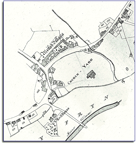
| Meifod in 1840 | ||
|
The map below is based on the tithe
map of 1840 and gives us an idea of
the village of Meifod in the early Victorian
period. |
|
TITHE MAPS In Victorian times almost everyone had to pay tithes to the Church of England. At the beginning of the reign the tithe became a tax on your property. The maps were drawn to see what property everybody had |
|
|
This small village was home to a
thriving community of people at this time. The parish of Meifod, which
included the countryside around the village, had 16 shoemakers,
8 blacksmiths, 5 wheelwrights
and 4 dressmakers, as well as the
butcher, baker and grocer we would expect. |
||
|
|
||