Llanfyllin
Some Victorian maps
  Meifod in 1902  
 

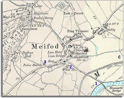
The map below is based on an Ordnance Survey map of 1902 showing the village at a scale of 6 inches to 1 mile.
It gives us a picture of the community at the end of the Victorian period.
There do not appear to be a great many changes from the time of the tithe map but there are some which have affected lives in the area.

 
  Map of Meifod in 1902
 

1. The River Vyrnwy is further away from the village. Its course has changed slightly since 1840, and a flood bank has been built to protect the village from flood waters

.2. The farm known as Red House in 1840 where the schoolmaster lodged is now called White House.

3. A new police station has been built so that the community now has a local policeman living among them for their protection.

Compare with Meifod in 1840...


Back to Llanfyllin maps menu


Link to sources
Back to top
Go to Llanfyllin menu