
TITHE MAPS
In Victorian times almost everyone had to pay tithes to the Church of England. At the beginning of the reign the tithe became a tax on your property. The maps were drawn to see what property everybody had
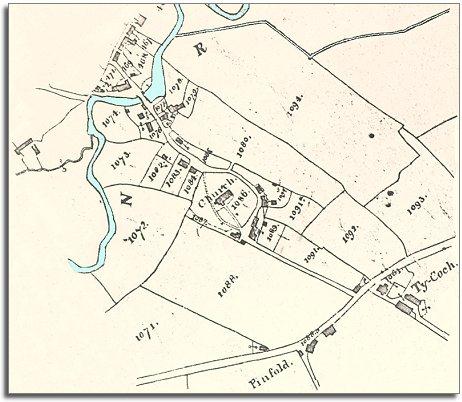
| Llanfechain in 1840 | ||
|
The map below is based on the tithe map of 1840, and it gives us an idea of the village of Llanfechain in the early Victorian period. From the map we can see that the community developed at a convenient crossing point over the River Cain on a route along the valley into England. |
|
TITHE MAPS In Victorian times almost everyone had to pay tithes to the Church of England. At the beginning of the reign the tithe became a tax on your property. The maps were drawn to see what property everybody had |
|
|
The census
returns for 1841 tell us who lived and worked here around that
time. |
|
|
|
|