| Llanfechain in 1902 | ||
|
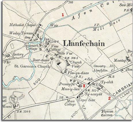
The map below is a section of a map
made at a scale of 6 inches to
1 mile in 1902. |
|
|
1. The course of the River Cain has been altered, making it straighter and probably helping to protect the village and meadows from flooding in wet weather. 2. The railway has come to the village. The Llanfyllin branch of the Cambrian Railway passes close to the village. Llanfechain station is just off the map to the east. This new development in transport put local people and busunesses in better contact with the towns and cities of Britain. 3. The village has been enlarged. Here we can see that many new homes have been built in the village. Although the population in the countryside went down in Victoria's reign, bigger and better homes were built for local people. |
|
|
|
|