Builth and district
Victorian maps
  Llanafan Fawr and Llanfihangel Brynpabuan in 1833  
 

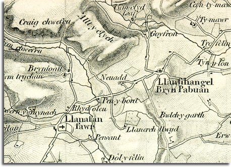
The map below is another enlarged section of an Ordnance Survey map made at a scale of 1 inch = 1 mile in 1833. Although it is not very detailed it does give us an idea of the area in the early Victorian period.
The way the map is shaded gives us a very good idea of the shape of the landscape. From this you can see that Llanafan Fawr and Llanfihangel Brynpabuan developed on the slopes on either side of the Chwefru river.


  The road passing through both hamlets is the old road which connects the Wye valley and the routes down into West Wales through Llanwrtyd. To the North of the map we can see tracks and roads going off to the farms and holdings on the slopes of the high ridges.  
  The people of the area would have nearly all been involved in working on the land in some way at this time. For farm labourers, shepherds, millers and farm servants ordinary life would not have changed much in the previous hundred years. They would almost certainly have been Welsh speakers with little or no English.
.


Back to the Builth maps menu

Back to top
Go to Builth menu