Brecon and district
Victorian maps
  Merthyr Cynog in 1887  
 

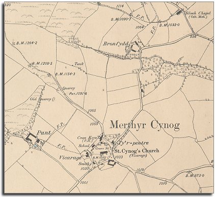
The map below is a section of a map made at a scale of 6 inches to 1 mile in 1886.
It is more detailed than the 1840 tithe map but we can see straight away that very little has changed in the 47 years since the tithe map was surveyed.


6in map of Merthyr Cynog
  Perhaps the biggest change we can see from the map is the small school which has been built by the parish church. This offered local children an education and a chance of getting a better life for themselves when they grew up. Even so,most of the children in this school in 1887 probably went on to do the same sort of jobs that their parents had done.
(Find out more from our pages on Victorian school life in the area).
.
 
  Compare with map of the area in 1840...  
 

Back to Brecon maps menu


Link to sources
Back to top
Go to Brecon menu