Some watermills of the Rhayader
area
Argoed Mill 1
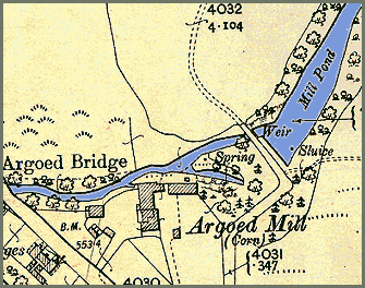
As with other mills in the area the exact origins of this mill are unclear but the first edition of the 1" Ordnance Survey map for the area appears to show buildings and what could possibly be a mill pond. (Compare with the later 25" map below). The mill stands on Nant Treflyn, a tributary of the Wye, not far from Doldowlod Hall.
Detail from
1st edition
Ordnance Survey
1" map of 1833
Powys County Archives
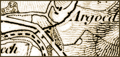
Image based on
2nd edition
Ordnance Survey
25" map of 1904
Powys
County Archives