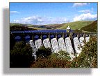
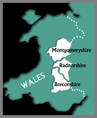
The mid-Wales county of Powys brings together the three ancient counties of Montgomeryshire, Radnorshire and Brecknock (now commonly known as as Breconshire).
Covering some 2000 square miles, it extends from the edge of Snowdonia in the north to the Swansea Valley in the south.
To the west lies the Cambrian mountain range, and to the east an eighty-mile border, much of it close to the ancient earthworks of Offa’s Dyke, is shared with England.