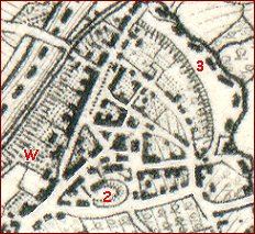
Here
are 2
maps of Hay.
1" to 1 mile
(left) and
25" to 1 mile
(right). They
have been
adjusted to
compare them
more easily
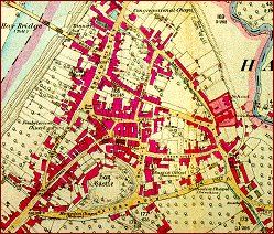
maps of Hay.
1" to 1 mile
(left) and
25" to 1 mile
(right). They
have been
adjusted to
compare them
more easily
| The maps on the website | ||
|
The National Curriculum emphasises
the need to give children an awareness of changes across time by making
comparisons. |
||
|
Here
are 2
maps of Hay. 1" to 1 mile (left) and 25" to 1 mile (right). They have been adjusted to compare them more easily |
|
|
|
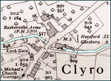
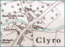
Occasionally on the website we have
used a very detailed Ordnance Survey
map surveyed at the huge scale of 25" to 1 mile. These maps are a
wonderfully detailed local history source but carry so much information
they can be very difficult to interpret at the KS2 age range. |
||
  |
||
|
As you can see from the above maps and many others across the website, we have coloured in the rivers, streams, canals and mill races in blue to make the maps easier to interpret.
|
||