| |
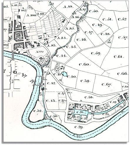
The
town of Newtown expanded with the coming of the canal and the building of
bigger flannel mills. This corner of Llanllwchaearn parish was the industrial
area of the town. |
|
| |
At
the bottom of the map you can see the canal basin
where barges would come in bringing lime and coal and would load up with
flannel and timber. The buildings around the basin belonged to the Canal
Company. As well as the warehouses there were timber
yards, lime kilns and stables
and some of the canal workers lived here with their families. |
|
| |
At
the top of the map across the Long Bridge lies Penygloddfa. This was an
area of streets of houses for workers. You can see the allotments
for the inhabitants just to the East, laid out as squares along the hillside.
Growing your own food was important to families trying to get by on very
little. |
|