| |
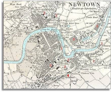
1.
The map shows a gas works
where coal gas is made by heating up coal so that it gives off gas. This
was then used for street lighting and in the home in gas cookers and gas
lights. The coming of the railway made the coal cheaper to transport into
the town. |
|
| |
2.
The map shows
new schools in the town in 1903 (all
marked 2 here). Although there were schools in the town at the time
of the tithe map, by the end of Queen Victoria's reign all children received
an education and had to go to school . This began to offer children better
opportunities at work when they left school. |
|
| |
3.
Industry has grown in Newtown since 1845.
3 new factories are marked here: the
Cambrian and Kymric flannel mills and the tannery by the river. |
|
| |
4.
The railway has come to Newtown. This
meant local produce could be sold in towns all over Britain. It also meant
that cheap goods from outside were sold locally putting some local craftsmen
out of business. The railway also made the possibility of travel much more
widely available. |
|